You'll always have exactly the right kind of map with the uniquely versatile DeLorme Atlas & Gazetteer. These indispensable atlases cover individual states with unequaled detail, including back roads, land contours, lakes and streams, boat ramps, forests, wetlands, trailheads, campgrounds, public lands, hunting and fishing spots, and much more.
Map, fishing maps, charts, info and gear for fly fishing , anglers, and outdoors sportsmen.
DeLorme Atlas & Gazetteer
 

DeLorme Atlas and Gazetteer
Atlas
You'll always have exactly the right kind of map with the uniquely versatile DeLorme Atlas and Gazetteer. These indispensable atlases cover individual states with unequaled detail, including back roads, land contours, lakes and streams, boat ramps, forests, wetlands, trailheads, campgrounds, public lands, hunting and fishing spots, and much more.
See also
$19.95
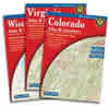
Please select the state above you are interested in

Checkout safely at NCFishAndGame with Paypal[Fly Shop] Most orders over $50 shipped free!!!
Wouldn't it be nice to always have exactly the right kind of map, whatever your needs may be? You will, with the uniquely versatile DeLorme Atlas & Gazetteer Series. These topographic atlases cover individual states with the most comprehensive detail available, including back roads, backwater lakes and streams, boat ramps, forests, wetlands, trailheads, campgrounds, public lands, prime hunting and fishing spots, and countless landmarks and points of interest. You'll also find a wealth of information on everything from family outings to wilderness adventures. The Atlas & Gazetteer is ideal for outdoor recreation, business travel, home or office reference, and countless other uses.

Rely on the Delorme Atlas & Gazetteer for the utmost in trip planning and backcountry access. Each volume contains topographic maps with unbeatable detail, plus gazetteer information on great places to go and things to do. Each Delorme Atlas & Gazetteer is a quality paperback; size 11" x 15-1/2" Detail commonly includes:

  • Back roads,dirt roads and trails,
  • Elevation contours
  • Remote lakes and streams
  • Boat Ramps
  • Public lands for recreation
  • Land use / land cover – forests, wetlands, agriculture
  • Trailheads
  • Campgrounds
  • Prime hunting and fishing spots
  • Museums/Historic Sites
  • Unique Natural Features
  • State and National Parks and Forests

Each Delorme Atlas & Gazetteer entry's location is cross-referenced to the corresponding map.

------ NCFishandGame.com info and links ------

[Suggestion Form] [Link to your site] [ ] [ ] [ ]
NCFishandGame.com has been a mostly volunteer site with substantial profits going to charity in North American.
Copyright © 2011/15 NCFishandGame.com, see legal. Rights reserved. with suggestions or questions.South River Interactive