California is a state of remarkable angling opportunities. California's Passport Challenge list includes 150 of the most popular sport game fish species. Here are some recommended fishing maps, charts, and books to help you fish the state of California.

[Home][Contacts][Newsletter][TackleShop]--[Back] [All US Maps]

California Fishing and CA Maps

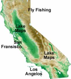
[California Rivers and Fly Fishing] [Los Angeles] [SF-NorCal] [California Lakes]
[California][Washington][Oregon][Nevada]

California Water Map San Francisco and Norther California Maps Northern California Maps California is a state of remarkable angling opportunities and a leader in the sheer amount and diversity of fishing experiences and outdoor opportunities that it offers. California includes 103 major streams and 74 major rivers. Total Inland Water Resources include 4,172 lakes and Reservoirs , 29,664 miles of streams that support fish including 17,958 miles of cold water streams and 7,763 miles of coastal streams with andromous fish populations. California encompasses approximately 1,100 miles of California coastline and 200 miles out to sea.

California's Passport Challenge list includes 150 of the most popular sport game fish species: 48 inland species, 86 ocean species and 16 marine and freshwater shellfish/invertebrate species [A1]. Some of the most popular include:

  • Ocean run such as Yellowtail, Barracuda, Tuna, Billfish, Albacore and Bonito

  • Visit our "sister" Tackle Store. TackleTuna is now working and adding product often. TackleTuna.com will be a complete, full service tackle store in the future. Thanks for shopping there: like NCFishAndGame, TackleTuna.com is able to donate a substantial amount of sales to charity.

    Chinook Salmon and Halibut

  • Largemouth Bass, Striped Bass, and Catfish

  • Trophy trout including steelhead trout,

And other too numerous to mention.

California Fishing Links Outside NCFishAndGame.comCalifornia Department of Fish and Game


Fishing Hot Spot - Detailed Fishing Maps Fishing Hot Spots® sets the standard for others to follow. See Details. Each map is thoroughly researched, the information verified and cartography done digitally, with the most current and accurate GIS tools, to ensure an easy-to-read, accurate and affordable map. It's the map successful anglers have asked for by name for more than two decades. Our maps come in a variety of sizes and formats. Each body of water is carefully scrutinized and input is gathered from local experts and consumers as to what needs to be part of the product.

Fishing Hot Spots - Saltwater Chart
San Diego Inshore - San Clemente to Imperial Beach
San Diego's Mediterranean-like climate is second to none. Inshore anglers will find calico bass, sand bass, white sea bass and numerous rockfish species year-round. In summer, hard fighting yellowtail, barracuda, California halibut and bonito add to the excitement of any fishing trip. Featured Species: Barracuda, Bonito, Calico Bass, Halibut, Rockfish, Sand Bass, White Sea Bass and Yellowtail
See also
$19.95

Fishing Hot Spots - Saltwater Chart
San Diego Bay to Imperial Beach
A wide variety of fish are available to both the inshore and onshore angler throughout the year. The most active bite occurs between the months of April and October. Among the prime species are the California halibut and smaller members of the tropical grouper family. Featured Species: Barracuda, Calico Bass, Halibut, Sand Bass, Shortfin Corvina, Spotted Bay Bass, Spotfin Croaker, White Sea Bass and Yellowfin Croaker
See also
$19.95

Fishing Hot Spots - Saltwater Chart
San Diego Offshore - San Diego to Ensenada
San Diego's offshore banks boast some of the top angling opportunities Southern California has to offer. The crystal blue waters 30 to 80 miles offshore can produce yellowtail, albacore tuna, bluefin tuna, marlin and dorado. Featured Species: Albacore, Bluefin Tuna, Dorado, Marlin, Yellowfin Tuna and Yellowtail
See also
$19.95

Fishing Hot Spots - Saltwater Chart
Mission Bay
With more than 27 miles of shoreline and numerous access points, Mission Bay Park offers some of the top year-round, light tackle bay fishing in Southern California. While known for its spotted bay bass fishery, sand bass, California halibut, yellowfin croaker and white sea bass regularly frequent the area. Featured Species: Halibut, Sand Bass, Spotted Bay Bass, Calico Bass, White Sea Bass, Barracuda, Yellowfin Croaker and Spotfin Croaker
See also
$19.95

Fishing Hot Spots - Saltwater Chart
LA Offshore-Marina del Ray to San Clemente Island
Chasing giant schools of tuna is one of the most popular summertime activities in these waters. Discover marlin, yellowtail, Pacific barracuda and dorado. One of the most sought-after trophy species cruising the offshore banks here is the elusive striped marlin. Trolling the island waters can produce quality fish. Featured Species: Yellowtail, Yellowfin Tuna, Albacore Tuna, Bluefin Tuna, Marlin, Dorado, White Sea Bass and Barracuda
See also
$19.95

Fishing Hot Spots - Saltwater Chart
LA Inshore North-Oxnard to Marina del Rey
This area features more than a mile of sandy beaches for swimming, surfing, windsurfing, fishing and more. Plus, you can explore the tidepools, coastal caves and reefs. Because of this area's relative isolation from the city, the ocean adjoining this scenic expanse of coastline offers numerous fishing opportunities. Featured Species: Barracuda, Bonito, Calico Bass, Halibut, Rockfish, Sand Bass, Sculpin, White Sea Bass and Yellowtail
See also
$19.95

Fishing Hot Spots - Saltwater Chart
LA Inshore Central-Malibu to Long Beach Inshore
There are 88 cities within Los Angeles County, including the islands of San Clemete and Santa Catalina. The coastline is 76 miles long and it has the highest population of any county in the nation. The inshore waters of the nearby Pacific Ocean offer many recreational opportunities. Featured Species: Barracuda, Bonito, Calico Bass, Halibut, Rockfish, Sand Bass, Sculpin, White Sea Bass and Yellowtail
See also
$19.95

Fishing Hot Spots - Saltwater Chart
LA Inshore South-Palos Verdes to Orange County
Los Angeles County's sunny climate and magnificent Pacific coastline brings a tremendous blend of both water and land-based recreation. Featured Species: Barracuda, Bonito, Calico Bass, Halibut, Rockfish, Sand Bass, Sculpin, White Sea Bass and Yellowtail
See also
$19.95

Fishing Hot Spots - Saltwater Chart
Santa Barbara Channel Inshore Tajiguas to Oxnard
Lingcod, calico bass and various rockfish species are the primary wintertime targets in this area. Salmon can be found as early as March. Spring also provides the chance for a California halibut. Featured Species: Albacore Tuna, Calico Bass, Chinook Salmon, Halibut, Rockfish, Sand Bass, White Sea Bass and Yellowtail
See also
$19.95

Fishing Hot Spots - Saltwater Chart
Channel Islands Inshore
The clear, blue waters surrounding these federally protected islands are rich in marine life. You'll find an outstanding fishery that allows access to numerous species and habitats within a short distance from one another. The area is popular for anglers seeking exotic fishing opportunities without having to travel far.
See also
$19.95

Fishing Hot Spots - Saltwater Chart
Santa Catalina Island - San Clemente Island
There are a number of excellent fishing locations near these islands. Discover white sea bass, yellowtail, calico bass, halibut, barracuda and bonito throughout most of the year. The numerous canyons, walls and thick kelp forests near San Clemente Island provide premier habitat for a multitude of popular gamefish. Featured Species: Barracuda, Bonito, Calico Bass, Halibut, Yellowtail and White Sea Bass
See also
$19.95
 

[TackleShop] Free shipping over $50 on most items


Wilderness Adventures Press Guide Books
California's Best Fishing Waters
182 Detailed Maps of 31 of the Best Rivers and Streams in California completely revealed in excellent, detailed, full color maps showing every fishing access, campground, boat launch, tributary, and trail, along with great information about each section of water and nearby fisheries. Public land is clearly identified in color, and every possible access or state lease is easy to find with just a glance. Everything you need to know about Northern California's famous trout rivers and coastal steelhead streams to Yosemite National Park waters and small streams in the Sierras. Boat ramps, campgrounds, and roads and trails that allow additional access to every stream. River miles, public and private land, and a wealth of other useful information for anglers is also included. SB, lay-flat binding, 8 1/2 x 11 224 pages, 182 maps. Here is a list of waters included in the book: American, Carson, Eel, Fall, Feather, Garcia, Gualala, Hat Creek, Hot Creek, Kern, Kings, Klamath, Mad, Mattole, McCloud, Merced, Navarro, Owens, Pit, Russian, Sacramento, Lower Sacramento, Upper San Joaquin, Smith, Stanislaus, Trinity, Truckee, Tuolumne, Walker, East Walker, West Yuba.
$29.95 plus $6.95 shipping

[TackleShop] Free shipping over $50 on most items


Benchmark Atlas and Map -- See Detailed Map. Every atlas contains a wealth of factual information, including locations, web sites, hours, and phone numbers for campgrounds, natural wonders, museums, historic sites, and more. We go to the trouble to field check and verify our data, then organize it for convenience and intuitive ease of use. Benchmark's leadership status in state atlas publishing is your assurance that you’ll find cartographic and editorial excellence within our covers.

Benchmark Maps and Atlas
California Atlas
From its verdant mountains and vast deserts to the azure sea, California is rich in geographical diversity and natural beauty. Get to know the best of California with this recently updated and improved atlas. Now freeway exit numbers are shown and the Landscape Maps are clearer, brighter. The comprehensive Recreation Guide and accompanying maps are the perfect resource to plan the ultimate outdoor adventure.
See also
$29.95

[TackleShop] Free shipping over $50 on most items


SonarMap, Inc.

SonarMap, Inc. was established in 2000 to create a more accurate high definition fishing map. See a sample of these fine maps. Using advanced computerized hydrographic survey technology, they collected thousands of man-hours of data including water depth, lake bottom characteristics, sonar imagery and global positioning points for selected Minnesota lakes. SonarMap, Inc. then edited the survey data files to create maps marketed under the trade name ReelBottom® Fishing Maps. In response to their customers' requests for high quality maps of more of their favorite lakes, they are proud to offer Navionics® digital and paper maps.

Navionics Hotmaps
Casitas and Castiac, California
Single map. Color shaded depth contours, Major routes and highways, Double-sided with detailed area insets, Area points-of-interest, Top-down satellite photo overlay, Tear resistant, 3D lake overview, Water resistant, Measures approximately 24" x 36", and (folds to small booklet size).
See also
$19.99

Navionics Hotmaps
Clear Lake, California
Single map. Color shaded depth contours, Major routes and highways, Double-sided with detailed area insets, Area points-of-interest, Top-down satellite photo overlay, Tear resistant, 3D lake overview, Water resistant, Measures approximately 24" x 36", and (folds to small booklet size).
See also
$19.99

Navionics Hotmaps
Lake Berryessa, California
Single map. Color shaded depth contours, Major routes and highways, Double-sided with detailed area insets, Area points-of-interest, Top-down satellite photo overlay, Tear resistant, 3D lake overview, Water resistant, Measures approximately 24" x 36", and (folds to small booklet size).
See also
$19.99

DeLorme Atlas and Gazetteer
Atlas
You'll always have exactly the right kind of map with the uniquely versatile DeLorme Atlas and Gazetteer. These indispensable atlases cover individual states with unequaled detail, including back roads, land contours, lakes and streams, boat ramps, forests, wetlands, trailheads, campgrounds, public lands, hunting and fishing spots, and much more.
See also
$19.95
Please select the state you are interested in

[TackleShop] Free shipping over $50 on most items


Hook-n-Line
F201 Offshore Golden Gate-North Section (With GPS)
This two-sided offshore saltwater fishing map covers the Pacific Ocean offshore of the Golden Gate from Half Moon Bay north to Bodega Bay and Fort Ross. The map shows latitude - longitude lines, depth contours, islands, sea mounts, underwater canyons and well marked fishing locations. The reverse side of this map has listings for the fishing locations with GPS coordinates, water depths and fish species caught for different times of the year.
See also
$20.00

Hook-n-Line
F202 Offshore Golden Gate-South Section (With GPS)
This two-sided offshore saltwater fishing map covers the Pacific Ocean offshore of the Golden Gate from Point Sur at the south end to Point Reyes at the north end. The map shows latitude - longitude lines, depth contours, islands, sea mounts, underwater canyons and well marked fishing locations. The reverse side of this map has listings for the fishing locations with GPS coordinates, water depths and fish species caught for different times of the year.
See also
$20.00

Hook-n-Line
F203 San Francisco Bay Area (With GPS)
This detailed two-sided inshore saltwater fishing map covers San Francisco Bay, the Golden Gate area, San Pablo Bay, the Napa River and many rivers around the bays. The map shows latitude - longitude lines, depth contours, islands, marinas, boat ramps and well marked fishing locations. Tables have listings for the marinas, boat ramps and various waypoints all with GPS coordinates. Fishing locations are detailed in a chart with GPS coordinates, special notes, and fish species caught for different times of the year.
See also
$20.00

Hook-n-Line
F205 Eastern Delta Area (With GPS)
A detailed two-sided freshwater fishing map that covers the eastern end of the California Delta. The areas of the Delta shown include Mossdale at the south and up to Sacramento at the north end with all the rivers and sloughs in between. The map shows, depth contours, islands, marinas, boat ramps and many well marked fishing locations. Tables have listings for the marinas, boat ramps and various waypoints all with GPS coordinates. Fishing locations are detailed in a chart with GPS coordinates, special notes, and fish species caught for different times of the year.
See also
$20.00

Hook-n-Line
F204 Western Delta Area (With GPS)
A detailed two-sided inshore bay and freshwater fishing map that covers the western end of the California Delta. Areas of the Delta shown include the Carquinez Strait at the east, Mossdale to the south, and up to Walnut Grove at the north end. The map shows, the rivers and sloughs, depth contours, islands, marinas, boat ramps and many well marked fishing locations. Tables have listings for the marinas, boat ramps and various waypoints all with GPS coordinates. Fishing locations are detailed in a chart with GPS coordinates, special notes, and fish species caught for different times of the year.
See also
$20.00

The Trout Bum Diaries
Vol 1 - Patagonia
Patagonia' is a fly fishing adventure film that is the result of five months of sleeping in the dirt on a 12,000 kilometer journey across the bottom of South America. The film is done in a high action style with narration between music sequences. The film is filled with shots of real life trout bums sleeping in the dirt, exploring new waters, hiking streams, floating rivers, and of course, catching fish! You won't find any instruction here, and we guard all of our film locations by using imaginary names. This is pure fly fishing entertainment. Does 5 pound brook trout in a creepy middle earth style forest appeal to you? Horse-packing trips into glacial rivers? Tierra Del Fuego and the sea-run brown trout of the south? Pure fishing entertainment? You'll find it here...
See also
$24.95

[TackleShop] Free shipping over $50 on most items


Some Valuable California Fishing and California Fishing Map Links
California Fishing Links Outside NCFishAndGame.comCalifornia State Tourism - Official State Site
California Fishing Links Outside NCFishAndGame.comCalifornia Department of Fish and Game
California Fishing Links Outside NCFishAndGame.comPier Fishing in California - The complete coast and bay guide to shore based fishing
------ NCFishandGame.com info and links ------

[Suggestion Form] [Link to your site] [ ] [ ] [ ]
NCFishandGame.com has been a mostly volunteer site with substantial profits going to charity in North American.
Copyright © 2009/11 NCFishandGame.com, see legal. Rights reserved. with suggestions or questions.